Monday 10 March 2014

Raised Bogs

So before I move on to any more sites, I thought I should take the time to write a full post on how raised bogs are formed. They are an extremely important resource because of their ability to absorb excess water and because they are natural carbon sinks. All those floods we've been suffering the last few years would not have been nearly so bad if the bogs were still in a condition to soak up water, but in order to harvest them for peat, we have installed drains in the bogs to dry them. For studying the past, the bogs have given us the most amazing examples of archaeology, from trackways to boats to depositions. These are all things I'll discuss further in the series, but the real value is that organic material which normally does not survive can be recovered and very precisely dated. The bog allows us to study the climate and ecology of the past too, meaning we can reconstruct very well what the landscape of the past was like.

After the glacial retreat 15,000 years ago, we were left with quite a few shallow lakes in the midlands that had no way to drain. In conditions like this, plant material growing around the lake edge only partially decomposes and eventually forms a layer of dead plant material stretching across the surface of the lake. This is known as fen peat and at this stage in bog formation, it is fed by ground water so it is nutrient rich and of an basic Ph. As this layer grows and thickens, it can no longer reach the ground water and is instead fed by rainwater, creating a nutrient-poor and acidic environment. Plants which prefer this environment start to colonise the bog and, as layers of plant material decompose, it takes the form of a dome.

Sphagnum Moss

Among the plants which thrive in the bog is Sphagnum Moss, also known as the Bog-Builder. This moss can hold up to 20 times it's weight in water and it contributes to the bogs' ability to drain the surrounding landscape. We also find plants such as Bog Rosemary or Cranberries in the wet raised bogs. Because of the lack of nutrients, carnivorous plants are often found in bogs, such as Sundew which preys on insects.

Sundew


On hummocks or in drier bogs, if they have been affected by drainage for instance, we are more likely to find heather or bog cotton. Bog Asphodel is colourfully nicknamed the Bone Breaker because it was believed to affect cattle's bones.
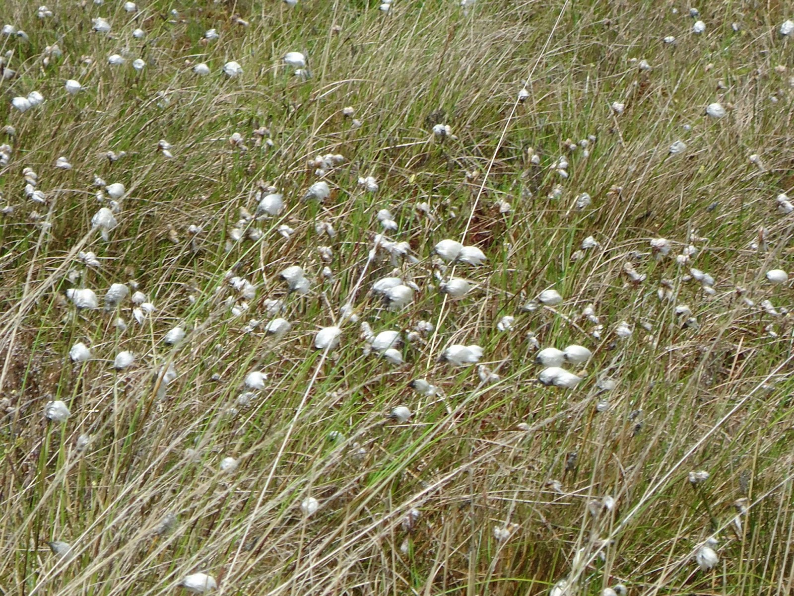
Bog Cotton

On the verges of the bogs, today we often see the conifer plantations, but birch and willow are the trees which we would expect to see in a natural environment. Many of the trackways which archaeologists have uncovered in the bogs are constructed from birch, showing how convenient a resource it was.

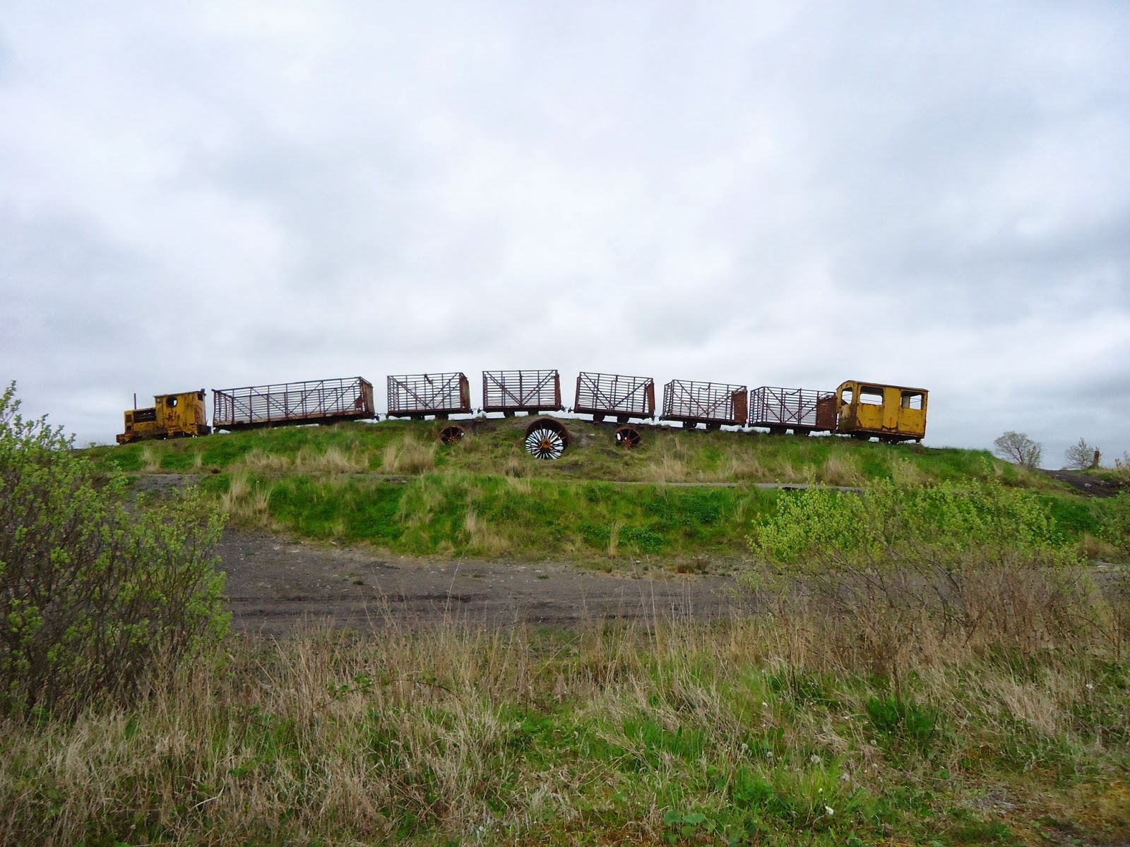
The wetlands were used for commercial forestry over the last several decades and this has had a damaging effect on the drainage of the bog and the ability of wetland plants to thrive. Thankfully, projects such as the Raised Bog Restoration Project are attempting to remedy this by preventing the spread of non-native species and reducing the amount of pine forest on the wetlands.

Sunday 16 February 2014

Lough Boora, Co. Offaly


So my first blog post is on Lough Boora and you'll find the map here

Lough Boora is a beautiful area of parklands East of Banagher in County Offaly. This bog was the first cutaway bog that Bord na Móna ceased work in and it has since been converted into the parkland you can see there now. It has thrived as a habitat and is a favourite spot for bird watchers who might be lucky enough to see redshank, lapwings and even some of their very successful partridge population. I confess I know very little about birds, but I found myself wishing I did and I've since gotten a pair of binoculars. The parklands are arranged with a series of looped walks so you can choose your own distance and dedicated cycle paths will take you through the range of bog and farmland if you prefer a cycle. Part of the walk through the parklands takes you through a sculpture park of a series of enormous sculptures, inspired by the archaeological timber found at these sorts of places, and by the legacy of peat cutting over the years. If it's plants you're into, you'll find plenty of bog cotton, yellow furze and orchids. Woodland is regenerating on the drier parts with willow, birch and aspen.


The Sky Train sculpture

For me, the most interesting part of this attraction is the Mesolithic camp site which was discovered there in 1977 when the lake was drained by Bord na Móna for peat harvesting. At the time of use, the site would have been located on a storm beach of a lake of open water. Excavation by Michael Ryan from the National Museum of Ireland revealed a number of hearths which have been radiocarbon dated to tell us the site dates from about 7030-6400BC. Over 600 examples of stone tools were found and most of these lithics are part of the microlithic tradition of this period, produced with a method of indirect percussion involving a punch and hammer. These were mostly made from chert stone, which is what was used across Ireland at this time if flint was not available locally. The excavation also uncovered three complete polished stone axes, highly prized items which required many hours of polishing to create.

68% of the animal bones found here were of fish, mostly brown trout and eel. This is typical of a Mesolithic diet, which was predominantly fish based. That left 23% mammal bone and 8% fish. Of the animal bone, almost all was of wild pig, telling us there was forest nearby where they could hunt pig and gather nuts or fruit. Most plant matter doesn’t usually survive to tell us more about diet, but hazelnuts have been found which tells us that the site was used in the Autumn. The eel would have been fished in late summer and according to Van Wijngaarden-Bakker, the pig bones show they were probably killed in the summer.

Even today when walking around these parklands, it's quite striking how full of life it is. We're used to thinking of bogs as dead landscape, and to a certain extent this is true of the ones that are still being cut, but a couple of years has returned this bog to a living landscape. You can't walk a few feet without another bird call to enjoy, or the sight of one of the 130 different bird species there, though we don't have to worry about wild pig emerging from the forest as we take our Sunday stroll. The lake waters have carp, tench, bream and rudd, and although this is another example of how full of life this place is, they were all introduced in historic times and would not have been fished in the Mesolithic here.


A great spot for wildlife

What has it got to do with movement?
Most of our Early Mesolithic sites are found along the coast or within easy access of it. By finding a site of this period in the very centre of Ireland, we have shown that these hunter-gatherers moved much further inland than previously thought. At the time of this site’s use, many of the raised bogs which make up the Irish Midlands would still have been areas of open water, which is exactly the sort of eco-system which these people would have sought out for fishing. This means, that it is entirely possible that Early Mesolithic hunter-gatherers came inland, camping around lakes in the midlands, but they have now been covered in peat.

Our understanding of Early Mesolithic hunter-gatherers is that they were quite mobile, moving to different campsites according to season. As we've seen, Lough Boora was used in the summer and early autumn, and they would have used what resources they could before moving on to a more suitable location for winter. The usual model is that coasts were occupied in the spring, rivers and lakes in the summer (that's what we see here) and on to uplands for winter. So where did they come from before camping on this storm beach? Where did they move to afterwards? And how did they make the journey? Did they boat using a dug-out canoe? Or did they walk along the esker to the coast?

Maybe you'll ponder these questions if you take a trip there, or maybe you'll just enjoy a picnic and the sculptures, but it's certainly an attraction that has a lot to offer to all sorts of interests.


Sunday 9 February 2014

What's all this then?

I'm in a pretty fortunate position of having funding for my PhD research. It's not much, granted, but I feel it brings with it a certain amount of responsibility to disseminate my work as widely as possible. Most particularly, I feel that anyone so privileged as to spend their working week researching the past should spend at least a little effort in sharing some of that knowledge to all you wonderful tax payers who have made that possible. Here in Ireland, we have the most amazing archaeological sites that most of us travel past at high speed without a second thought to just how fascinating they are. While all our Boom Time motorways have made our heritage accessible, it also means that we mostly only get to enjoy it at 120km an hour. I hope to use this blog to remind people of just how awesome all those mounds of dirt and heaps of stone are.

My PhD research is on how we interact with the landscape in order to move through it and how this process creates routeways over time. I'm not going to discuss my actual research in any depth here - I've got to save that for my thesis! If you are interested though my abstract is here. My plan is to choose a site once a week and write a brief blog post on it. I have a map over on Google Maps Engine Lite where I'll place a pin on each of these sites so all of you lovely people can take in some of these great spots whenever you like. The major case study of my research is North Offaly and South Westmeath, so you're going to see a pattern in what sites I choose from week to week. As I describe each site, I'll add in a bit of discussion as to what it's got to do with movement. I'd like for you all to see these sites as I do, not just lonely ruins in the middle of nowhere, but important indicators of past networks where real people lived and breathed and moved around. None of this happened in isolation and proximity to a routeway would be vital for a community to thrive.

For those of you in the know, my study area is a landscape of esker and bog, which has an enormous effect on movement. These bogs would have started to form about 10,000 years ago as undecomposed plant material clogged up shallow lakes. A fen is formed which eventually grows so thick that it is no longer fed by alkaline groundwater, but by rainwater. It is at this point that the bog becomes a raised bog which is what we have so much of in the Irish Midlands. I'll write a full post of bog formation another day, I just want to give a brief background in this post of what to expect.

Eskers were formed slightly earlier at around 15,000 years ago and consist of long ridges of gravel and other sediments which were left behind after the glaciers. As the glaciers moved through the country, a number of underground rivers formed beneath the ice sheets. These rivers filled with beds of gravel and sand, which were deposited with the retreat of the glaciers. These deposits are known as esker ridges and are slightly elevated and well-drained, so of obvious benefit when there are expanses of bog on either side. Again, I'll write more on this later.

I've thought long and hard about whether or not to give bibliographies with my posts because I want to avoid this project becoming too academic, but I think in the interest of transparency I should. This way, if you feel intrigued enough to delve a little deeper into the past, you have everything you need.

Most people think I'm weird when I get excited about bogs and eskers, but I hope you'll all join me in my enthusiasm as I take you through some of the great ways you can experience them

Yolande.